
Coordinate systems in ArcGIS 10
One thing that has always frustrated me in ArcGIS is selecting coordinate systems. ArcGIS does feature a “favourites” options for coordinate systems but this only appears in a couple of dialog boxes.
The solution: Just copy and paste the coordinate system files to the same folder as all your coordinate systems.
On my computer the path was C:\Program FIles (x86)\ArcGIS\Desktop10.0\Coordinate Systems.
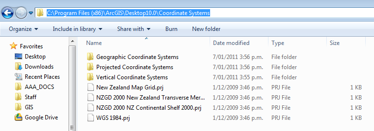
copy and paste coordinate systems you use often
Now when I browse they appear right under coordinate systems.

Quick access to coordinate systems
Datums and Projections
A basic understanding of datums and projections and how they are used is essential for anyone conducting research with a mapping/spatial component to it.
A reasonably good summary of geodetic datums and projections is written here (read this summary first) : http://www.linz.govt.nz/geodetic/find-out/understanding-datums/index.aspx
Some Key points about datums and projections
In general
- The most important thing to know is what datum + projection the data are in
- When someone gives you data ask about what datum + projection the data are in.
- Check what the GPS is set to!
- People may tell you “The data are in Lat long” this is not a datum, it is a way of expressing the positions in a datum! Latititude and longitude could be given for any datum! (it is most likely that data will be wgs84 datum).
NZ data specifically
- If you are entering location data into a spreadsheet put the datum or projection in the header (e.g. |Easting_NZTM| Northing_NZTM| )
- When reporting eastings and northings report eastings first (like other x,y coordinates). For latitude and longitude, latitude is often reported first (not sure why this is).
- There is ~200m difference between nzgd1949 and nzgd2000 datums
- For NZMG and NZTM the easting is always the smaller of the two (unless you are using it outside of onshore nz- which you shouldn’t).
- NZTM and NZMG Eastings/ northings are of the order of a million metres. So if you see one that that is “123456” or “12345678”, they are wrong (probably mistyped).
- NZMG eastings begin with 2 e.g. 2345346 and NZTM eastings usually begin with 1 (e.g. 1345657). There is no overlap in the coordinates for onshore New Zealand (see map below). This is by design.
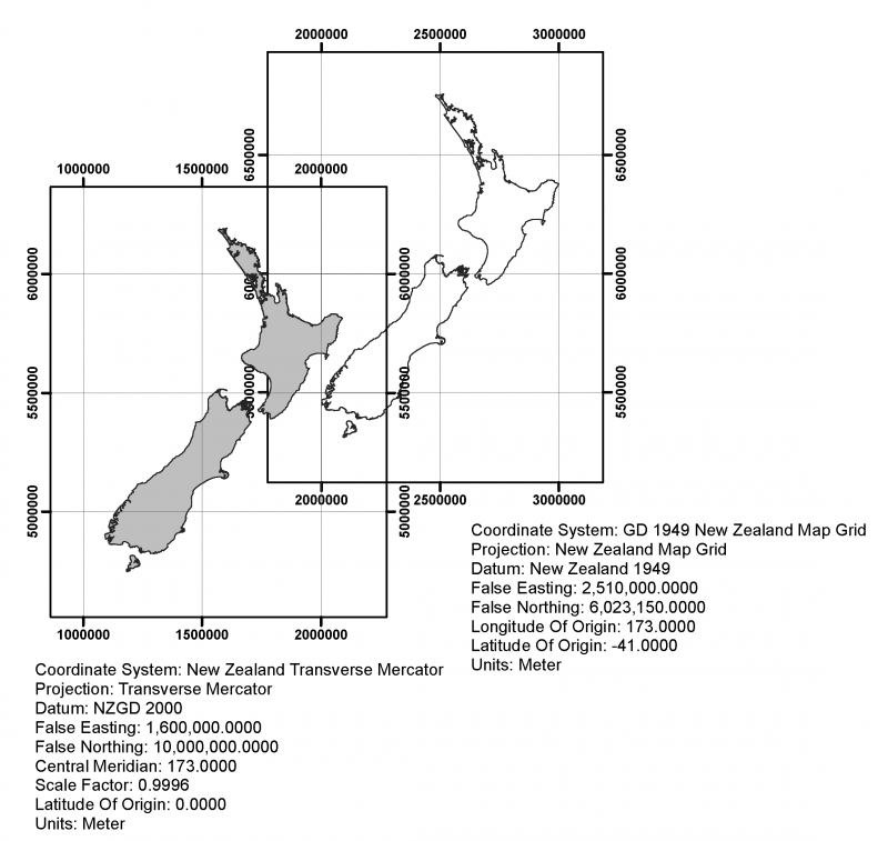
Comparison between projections used in New Zealand
For more info go to: http://www.linz.govt.nz/geodetic/datums-projections-heights
Welcome
This is my first post. This blog will be used for disseminating information primarily for geology department staff and students. Find out more about this blog. I hope to have posts with illustration and GIS tips and tricks and announce upgrades and changes to equipment and software etc. around the department.
