
Grid reference systems: how to make them
All about how to make grid reference systems. Before you try to make your own you should read this page:
Making a grid reference system
For any map you can make your own grid reference system, so that you can refer to any position in the text of your document. If you have more than one map, then label your map sheets and include that in the grid references.
- Use an existing coordinate system such as NZTM.
- You first need to set the grid interval to a multiple of 10 such as 10,000m, 1000m, 100m, 10m. Leave the first two numbers to the left of the trailing zeros only. For example:
1512000, 1513000… becomes 12, 13…
1512100, 1512200… becomes 21, 22…
- You should label the full numbers in at least one corner.
Making a Grid reference system using ArcGIS
You can use ArcGIS to make grid reference systems for any map.
- Go to View>Data Frame Properties>Grids Tab
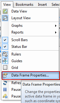
- Click on New Grid
- Choose Measured Grid
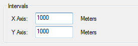
- Choose your interval e.g. 1000m
- Make the x and y interval the same.
- Click through to finish.
- Select the grid and choose properties
- Go to the Labels tab
- Select Corner Label as the label type.
- Click on Additional properties

- In the Corner labels tab you can set where full corner labels will appear.
- In the Principal digits tab you can set how many principal digits appear and how many base digits appear
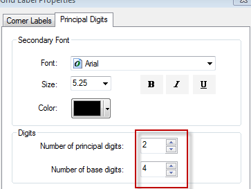
- Leave principal digits at 2. The base digits correspond to the number of digits from the right hand side. If your interval is 1000m this should be set to 4, for 100m this should be 3 and so on.
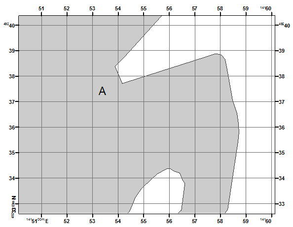
Below is an example of a map covering only Port Chalmers, Dunedin with a 100m grid and a grid reference system. On this map point A is at 533 733 (10m precision).
Below is a zoomed in map covering a smaller area around A with a 10m grid and a grid reference system. On this map point A is at 326 717 (1m precision).
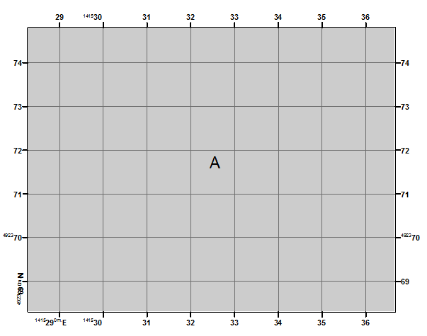
To get full coordinates we can simply add the rest of the numbers shown in the corner label.
A is at 1415326 m E 4923717 m N
Best practice for using a grid reference system in a document
- Refer to locations using a grid reference system in the text of a document ONLY when a map accompanies it.
- Locate features also using some kind of ID system. i.e outcrop number.
- List all of the localities you refer to in the text in a table in the appendix. In this table you should provide:
- the locality ID
- full grid references (i.e. NZTM)
- grid reference system numbers.