Training section: 3D Geology diagram techniques
I’ve just added a new set of pages in the training section of this website. These tutorial pages cover 3D Geology diagram techniques. The first tutorials for 3D diagrams using a mixture of free and non-free software are live now. I will also make alternate versions of these tutorials that use only free software soon.
Working with Wikis (websites) on blackboard (v9.1)
This page explains the basics of working with wikis (websites) on blackboard Learning management system. Instructions apply to version 9.1. Have a look at the planning section below, then check out the video or text instructions.
[Instructions UPDATE (8/9/2015)]
Here are a couple of tips to make things a bit easier:
Adding XY data to ArcGIS
This tutorial covers adding XY data to ArcGIS, so that you can view and work with the data in ArcGIS. By XY data I mean point data such as foliation that has a spatial (XY) component associated with it.
Dedicated cathodoluminescence microscopy (incl. image capture) setup
A few people have been using the Cathodoluminescence microscopy (incl. image capture) equipment that Brent Pooley and I set up. We have, until now, been sharing the image capture part with the photomicrograph setup in the Graphics Lab. This was quite inconvenient and it meant that the Photomicrograph setup, which gets used a lot, was often unavailable.
We are pleased to announce that we now have a dedicated Cathodoluminescence microscopy (incl. image capture) setup. This also means that the Photomicrograph setup will now have uninterrupted availability. Instructions and training are available for both setups, contact me (photomicro, CL) or Brent (CL) for training.
Scanning instructions and Learn to scan
Scanning instructions
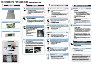
I have put a poster in the Graphics Lab above the scanners. This posters provides very basic instructions for common scanning tasks.

Learn to Scan
I have also prepared a quick scanning training exercise for people who want to use scanners. It is designed to be used with the scanning poster. I recommend that anyone who wants to use scanning equipment should go through this training exercise. Come see me to collect the training exercise.
Any feedback on the poster or training exercise is very welcome.
