Led by Professor Mark Stirling, this post-workshop field trip will focus on observations pertaining to strong non-poissonian behaviour of some of the active faults in Central Otago. We will also visit Clyde Dam, the site of the first-ever use of ancient fragile geologic features to evaluate a seismic hazard model for a major engineered facility.
What you need to know:
- Dates: 16-18 November
- Location: Oamaru – Central Otago – Queenstown
- Accomodation: Central Park Apartments in Cromwell. Shared rooms are available and accomodation is included in your field trip fee. Check back here for accomodation booking instructions – coming soon!
- Transportation: Transportation will be provided from the workshop venue in Oamaru at 2pm on 16 November, throughout the field trip, and you will be dropped off in Queenstown (the bus will stop at the airport and in the city) by 4pm on 18 November.
- Meals: You will be responsible for your own meals on the field trip. We will have bookings for some of the group for dinner, but you will be responsible for the cost.
- Cost: $225 NZD (includes accomodation and transportation). The final cost per person will be determined after the registration deadline on 31 August. You will be contacted with a payment method by 30 September.
- Field Trip Sites:
- Dunstan Fault
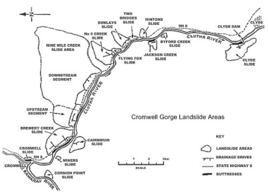
- Cromwell Gorge landslides
- Clyde Dam
- Precarious rocks near Clyde Dam
- Cardrona Fault
- Kawarau Gorge


Detailed field trip guide
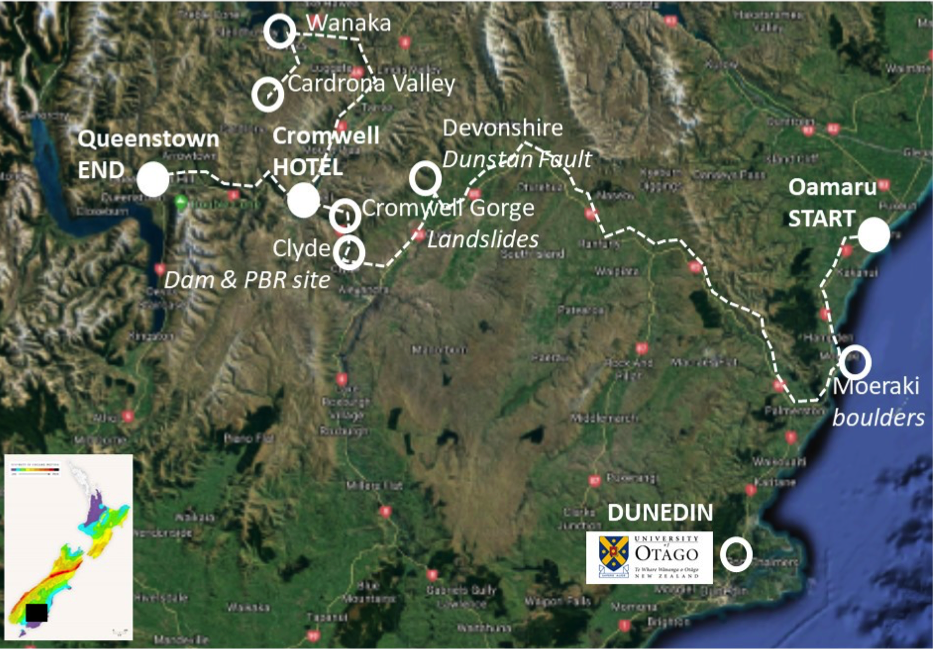
This field trip will take participants into the middle of the central Otago “Range-and-Basin” region, where transpressional tectonics east of the Alpine Fault have produced a distinctive topography and rain shadow climate. It is one of New Zealand’s most intensively-studied areas in the context of Quaternary earth science, and is known for producing New Zealand’s finest Pinot Noir. Over the last four decades the region has seen major studies of large landslides, active faults, and seismic hazards. The studies have been motivated by the need to understand the potential impacts of geologic hazards to hydropower developments, and secondary impacts to the downstream areas. The field trip will include: the landslides of the antecedent Cromwell Gorge, foci of extensive studies in the late 1980s to early 1990s; the Dunstan Fault, the most active and well-studied fault in central Otago; the Clyde Dam, the largest concrete dam in New Zealand; precariously-balanced rocks (PBRs) of Cairnmuir Flat, which have been used to quantify seismic hazard estimates for the Clyde dam, the upper Clutha River area (Cardrona Valley and Wanaka), and; the Kawarau Gorge. The field trip will finish in the tourist mecca of Queenstown, and we will undertake the journey by bus and accompanying minivan. Temperatures will be in the 16-25oC range, but with the potential for cold southerlies and windy northerlies. Participants should come prepared for warm to cold, and dry to rainy conditions. Good footwear should be worn as one of the days will involve a walk on a dirt road. The route is shown in the accompanying map, and brief illustrated agenda is also provided.
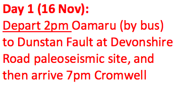
Nov 16: Oamaru to Cromwell
- Depart Oamaru 2pm. Travel to Palmerston, visiting the Moeraki boulders along the way
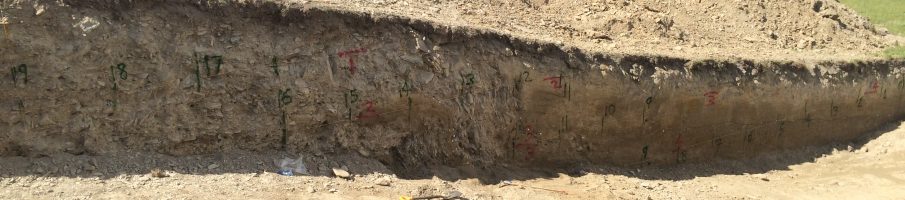
- Inland to central Otago, visiting the Devonshire site of the Dunstan Fault, where multiple late Quaternary scarps are present, and trenching investigations were carried out for hydro power development in the 1980s and 2000s
- To Cromwell township by 7pm, where we will stay both nights
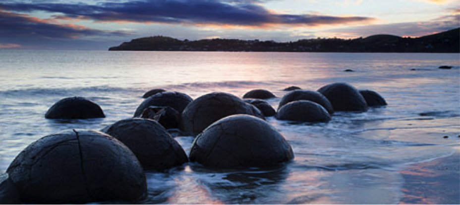
Moeraki boulder concretions (source moerakiboulders.co.nz)
Dunstan Fault, which is marked by the boundary between shade and sun in the middle distance (Source Lloyd Homer collection, GNS Science).
Nov 17: Cromwell-Clyde area
- Depart Cromwell 930am. Travel to the Cromwell Gorge, stopping to observe the site of major landslide investigations for hydropower development in the late 80s/early 90s
- Clyde hydroelectric dam, the largest concrete dam in New Zealand
- Clyde township for lunch
- Cairnmuir Flat PBR site. The access to the PBR site is up a steep dirt road, so access will involve walking up the road and enduring a 400m elevation gain. Those who choose not to do the walk will have time to enjoy a local vineyard
- Back to Cromwell township by 6pm
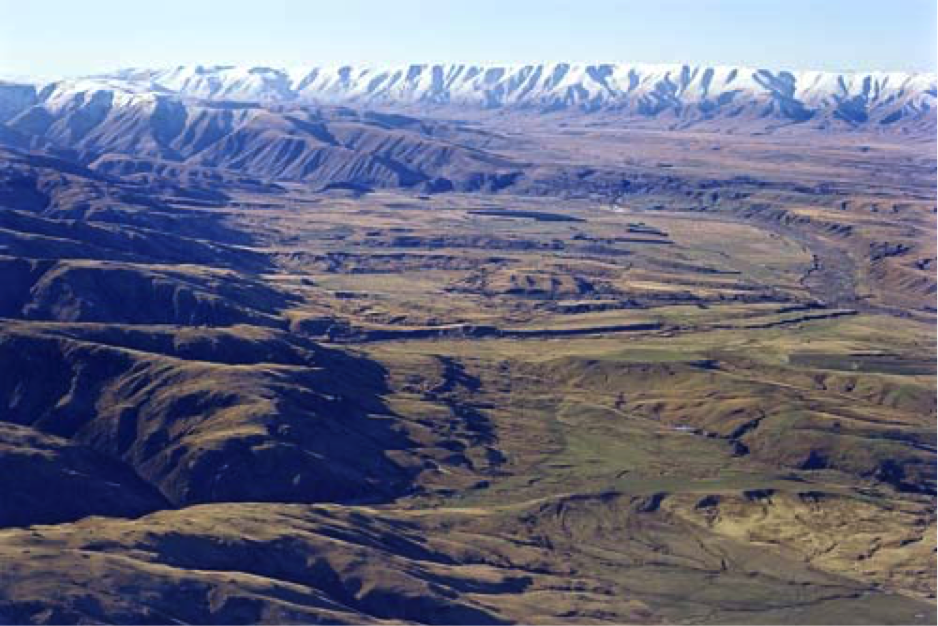
Cromwell Gorge landslides (Source mightyclutha.blogspot).
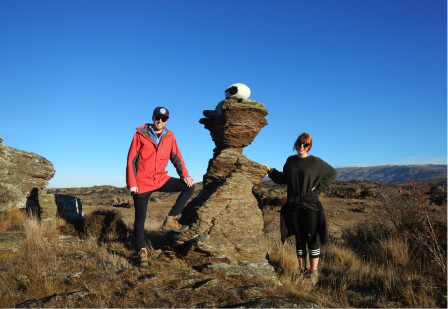
One of the PBRs at Cairnmuir Flat. The narrowest part of the tor marks the boundary between the PBR and pedestal (Photograph by Mark Stirling).
Nov 18: Cromwell to Queenstown
- Depart Cromwell 930am. Travel to Cardrona Valley via Pisa Fault and Upper Clutha River terraces
- Cardrona Fault in Cardrona Valley
- Wanaka for lunch
- Wanaka to Queenstown via Kawarau Gorge. Stop at Goldfields Mining Centre for touristy experiences
- Drop off participants at Queenstown airport by 4pm, and then downtown (hotels)
